

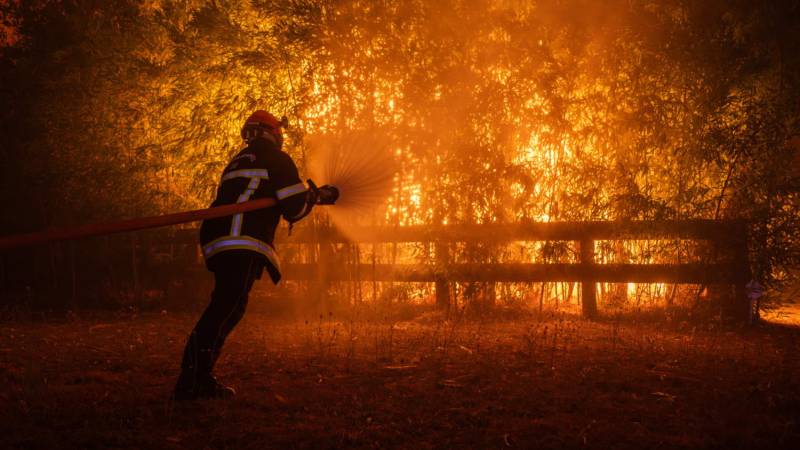
Open a global wildfire map today and the impression is deeply unsettling. Across continents separated by oceans, climates and political systems, red points marking active fires appear beside expanding smoke plumes and warning zones. Indonesia, Algeria, Greece, North America and parts of Europe have all supplied dramatic images during the 2026 fire season. Yet those glowing dots reveal only the visible surface of a much deeper problem. Behind every major wildfire lies an interaction between atmospheric physics, vegetation, soil moisture, land use, human behaviour, economic activity, settlement patterns and political choices. The wildfire crisis of 2026 must therefore be understood not simply as an environmental emergency, but increasingly as a socio-scientific crisis in which scientific evidence cannot be separated from questions of development, inequality, governance, public health and collective responsibility.
The geographical picture by the end of August 2026 illustrates the scale of the challenge. In the United States, the National Interagency Fire Center reported more than 52,000 wildfires and over 8.2 million acres burned by August 31, an area substantially above the ten-year average. Dozens of large fires were still being actively suppressed, more than 22,000 personnel were involved in firefighting operations and the country remained at its highest National Preparedness Level. Such figures measure more than burned land. Every major fire activates a vast institutional system involving firefighters, aircraft, emergency shelters, evacuation networks, road closures, public-health warnings, logistics and enormous public expenditure. Modern wildfire is therefore simultaneously a physical event and a test of state capacity.
Europe presents another complex picture. By late August, hundreds of thousands of hectares had burned across the European Union. Although the total remained below the extraordinary level observed during the same period in 2025, it was still well above the long-term average. Severe fires affected parts of Spain, France, Greece, Italy and the Balkans, while significant events were also recorded at unexpectedly northern latitudes, including Belgium and western Germany. Such geographical expansion matters because risk is shaped not only by hazard but by familiarity. Regions with long experience of recurrent wildfire tend to possess established firefighting systems, public awareness, evacuation procedures and building practices. Historically lower-risk regions may be less prepared when severe fire weather begins to occur more frequently.
North Africa has revealed the human tragedy concealed behind statistics expressed in hectares. Fires in northeastern Algeria killed people and injured dozens during late August, while Greece endured destructive summer fires that caused deaths, evacuations and widespread loss. A figure such as “thousands of hectares burned” can sound abstract. For affected communities, however, each hectare may include a home, orchard, farm, school, road, business, grazing area or place of memory. The social life of a community cannot be measured in satellite pixels. Long after vegetation begins to recover, households may continue dealing with displacement, debt, unemployment, trauma and the difficult decision of whether to rebuild or leave.
Indonesia may represent one of the most troubling emerging centers of the 2026 fire season. Dry-season fires intensified across Borneo, Kalimantan, Sumatra and Papua, and smoke affected neighbouring Singapore and Malaysia. School closures demonstrated how a fire occurring in a forest or peatland can rapidly become an educational and public-health disruption. Indonesia’s extensive peatlands create particular difficulty because peat can continue smouldering underground even after surface flames appear extinguished. Such fires are difficult to detect fully, difficult to suppress and capable of releasing large quantities of smoke and stored carbon. In peat landscapes, the crisis therefore involves not only fire behaviour but hydrology, land management, agricultural economics and climate policy.
These events can easily create the impression that the entire planet is burning more than ever before. Television footage of walls of flame, satellite images of smoke crossing continents and social-media videos of evacuation convoys reinforce that perception. Yet scientific responsibility requires caution. Wildfire behaviour varies enormously among ecosystems, regions and years, and different measurements can tell different stories. A severe fire season in several populated regions does not automatically mean that every global fire indicator has reached a historical maximum. The distinction between local extremes and global totals is essential if public discussion is to remain scientifically credible.
This point is especially important because wildfire datasets measure different things. A thermal “hotspot” detected by satellite is not the same as hectares burned. Hectares burned are not the same as fire intensity. Fire intensity is not the same as carbon emissions. Carbon emissions are not the same as deaths, displacement or economic loss. A relatively small fire entering a densely populated settlement may create a much greater humanitarian disaster than a fire hundreds of times larger burning in an uninhabited landscape. Similarly, a smouldering peat fire may produce extraordinary smoke and carbon emissions while behaving very differently from a wind-driven grass fire. Scientific indicators answer different questions, and policy becomes distorted when they are treated as interchangeable.
The public often encounters wildfire through dramatic images, while scientists understand it through interacting variables. A photograph of a burning forest may be emotionally powerful, but it does not explain why the fire became severe. Researchers examine temperature, rainfall, relative humidity, wind speed, vegetation condition, fuel availability, soil moisture, topography, ignition source and previous land management. Social scientists then ask additional questions. Who lived in the threatened area? Were evacuation routes adequate? Could residents leave quickly? Were houses built with fire-resistant materials? Could households afford insurance? Had authorities reduced hazardous vegetation? Were emergency warnings trusted? Wildfire becomes a socioscientific issue precisely because no single discipline can explain the complete disaster.
The same scientific caution is necessary when discussing climate change. Climate change does not directly “start” every wildfire. Fire still requires ignition. Lightning is an important natural source, while cigarettes, campfires, machinery, electricity infrastructure, agricultural burning, deliberate land clearing, arson and negligence provide many human sources. Confusing ignition with environmental conditions weakens rather than strengthens the climate argument. The more accurate explanation is that climate change can alter the background conditions in which ignition occurs, making landscapes more capable of supporting rapid and destructive fire.
Higher temperatures increase evaporation and accelerate the loss of moisture from soil and vegetation. During prolonged drought, grasses, shrubs, branches and forest litter become increasingly combustible. Hotter and drier conditions may lengthen fire seasons, while strong winds can drive flames rapidly across landscapes and carry burning embers far ahead of the main fire front. Under such conditions, an ignition that might once have remained limited can become a major emergency. Climate change is therefore best understood as a risk amplifier: it can increase the probability, duration or intensity of conditions favourable to extreme fire behaviour.
Fire and climate can also interact through feedback mechanisms. Burning vegetation releases carbon, while peat fires can release carbon accumulated over long periods. Repeated forest destruction may weaken the capacity of ecosystems to absorb carbon dioxide in the future. High-latitude fires can be especially consequential when they affect carbon-rich soils and peat deposits. Warming can therefore create conditions more favourable to fire, while severe fire can release additional greenhouse gases and weaken carbon sinks. The relationship varies by ecosystem, but it demonstrates why wildfire now belongs within the broader scientific discussion of climate-system feedbacks.
Yet climate cannot by itself explain why a wildfire becomes a disaster. Where society builds determines what fire destroys. Human populations continue expanding into the wildland–urban interface, where homes, roads, businesses, electricity networks and communities meet forests, shrublands and grasslands. Each new development in a fire-prone landscape adds people and assets to the area that may eventually burn. The result is not simply greater exposure to a natural hazard; it is the deliberate construction of vulnerability over time.
This forces policymakers to ask questions far more difficult than “How do we stop fires?” Where should housing be permitted? What building materials should be required? How wide should defensible spaces around homes be? Should electricity networks be redesigned or placed underground in high-risk areas? Who pays for vegetation management? Should governments restrict rebuilding after repeated destruction? These questions involve property rights, housing shortages, insurance markets, land values, local culture and political resistance. Science can estimate risk, but society must decide what level of risk it is willing to tolerate and who will bear the cost.
Fire itself is also not always ecologically destructive. Many ecosystems evolved with periodic burning. Some species depend on fire for regeneration, nutrient cycling or habitat maintenance. Decades of aggressive fire suppression in certain landscapes have sometimes allowed dead vegetation and other fuels to accumulate, potentially increasing the severity of later fires. For this reason, prescribed burning and Indigenous cultural-burning practices are receiving renewed attention. Carefully managed low-intensity fire can, in suitable ecosystems and conditions, reduce fuel loads and support ecological processes. The challenge is that controlled burning requires favourable weather, competent institutions and public acceptance, and climate change may shrink the safe windows during which it can be conducted.
The consequences of wildfire also extend far beyond the flame front. In many events, smoke is the most geographically widespread threat. Wildfire smoke contains gases and fine particles, including PM2.5, which can penetrate deep into the respiratory system and are associated with respiratory and cardiovascular illness as well as increased risk of premature death. Because smoke can travel hundreds or thousands of kilometers, people who never see a burning tree may still suffer measurable health effects. Wildfire therefore turns into an air-pollution emergency that can affect cities and countries far from the original fire.
Smoke exposure reveals another dimension of the crisis: environmental inequality. A wealthy household may have air-conditioning, high-quality filtration, private transport, flexible employment, insurance and sufficient savings to evacuate temporarily. A low-income household may possess none of these protections. Outdoor workers cannot always remain indoors during dangerous air-quality episodes. Children, elderly people and those with existing health problems may face greater risks. Schools may close, flights may be disrupted, tourism may decline and families may face medical expenses or lost wages. The same concentration of polluted air therefore does not produce the same social consequences for everyone.
The wildfire crisis of 2026 must therefore be understood not simply as an environmental emergency, but increasingly as a socioscientific crisis in which scientific evidence cannot be separated from questions of development, inequality, governance, public health and collective responsibility.
The destruction of homes and livelihoods deepens these inequalities. Families with comprehensive insurance and substantial savings may rebuild relatively quickly. Poorer households may lose most of their accumulated wealth in a single afternoon. Temporary displacement can interrupt children’s education, employment, access to healthcare and social support. Small businesses may never reopen. Agricultural communities can lose crops, livestock, equipment and future productivity simultaneously. Governments then spend large sums on shelters, emergency operations, reconstruction and compensation. Wildfire is thus a socioscientific crisis because a physical hazard becomes a social disaster through vulnerabilities that existed before the first flame appeared.
The danger is that emergency response becomes the dominant definition of wildfire policy. Repeatedly extinguishing emergencies without addressing the conditions that generate them resembles treating fever while leaving the underlying disease untouched. Fire suppression is politically visible. Prevention is not. Governments can display aircraft, emergency crews and command centers. By contrast, fuel reduction, wetland restoration, peatland rehabilitation, electrical-grid upgrades, safer building codes and improved planning may take years before their benefits are visible. Prevention therefore competes poorly for political attention even when it may save more lives and money over the long term.
UNEP has argued for a major rebalancing of wildfire expenditure toward planning, prevention, preparedness and recovery rather than concentrating resources overwhelmingly on response. Such an approach would require governments to think about wildfire before smoke appears on the horizon. It would include improved forest and peatland management, stronger regulation of deliberate land clearing, resilient electricity infrastructure, fire-resistant construction, defensible spaces around homes, prescribed burning where scientifically appropriate, satellite early-warning systems, evacuation planning, smoke-response protocols, clean-air shelters, ecosystem restoration and cross-border cooperation.
Technology can support almost every part of this transition. Satellites provide near-real-time information about thermal anomalies and smoke movement. Artificial intelligence can help analyze large volumes of meteorological and remote-sensing data. Drones can map inaccessible terrain. Improved forecasting can identify periods of extreme fire weather. Mobile networks can distribute evacuation alerts, while air-quality sensors can support public-health guidance. But technology is not a substitute for governance. An advanced warning system has little value if residents do not trust the authorities, evacuation routes are blocked, emergency services lack capacity or vulnerable people have no means of leaving.
Public trust therefore belongs at the center of wildfire resilience. Residents must believe evacuation instructions when authorities tell them to leave. Governments must communicate uncertainty without allowing uncertainty to become paralysis or false reassurance. Scientists must explain what wildfire maps and satellite products actually represent. Journalists must distinguish between a hotspot, a burned-area estimate and a humanitarian disaster. Policymakers must resist turning every fire into evidence for a predetermined political narrative. Effective risk communication requires neither minimizing danger nor exaggerating it. It requires communicating probability, uncertainty, exposure and vulnerability accurately.
Seen in this broader context, the wildfire map becomes much more than a disaster map. It is a map of relationships between energy, atmosphere, vegetation, technology and society. A red dot may begin with lightning, a cigarette, electrical equipment, machinery or an agricultural burn. Whether that ignition expands depends on temperature, humidity, wind, vegetation, soil moisture and available fuel. Whether it becomes a human catastrophe depends on another layer entirely: settlement patterns, poverty, infrastructure, building regulation, emergency preparedness, healthcare access, public trust and political decisions made years before anyone smelled smoke.
That may be the most important lesson of the 2026 wildfire season. The scientific question is no longer merely why forests burn. The physics and chemistry of combustion, heat transfer, atmospheric circulation and vegetation moisture are increasingly well understood. The larger challenge is explaining why particular fires become humanitarian disasters, why societies continue creating vulnerability in landscapes already known to be dangerous and why prevention repeatedly receives less attention than spectacular emergency response.
The future of wildfire management will therefore not be determined by firefighting technology alone. It will depend on how intelligently scientific understanding is translated into land-use policy, climate adaptation, public health, urban planning, ecosystem management, environmental justice and disaster governance. Countries that continue treating wildfire solely as an emergency-services problem will repeatedly find themselves responding after risk has already accumulated. Those that treat it as a long-term socioscientific challenge have a better chance of reducing both the physical hazard and the inequalities that transform hazard into catastrophe.
This is where the wildfire map stops being merely a collection of burning places. Each marker becomes evidence of a wider relationship between human society and a changing environment. The red dots remind us that disasters are rarely created by nature alone; they emerge when physical processes encounter vulnerable populations, poorly planned settlements and institutions that have failed to anticipate known risks. The fires of 2026 are therefore not simply warnings about forests, climate or weather. They are warnings about how we organize society, where we choose to build, how seriously we prepare for foreseeable danger and whether we are willing to invest in prevention before the horizon turns red.