

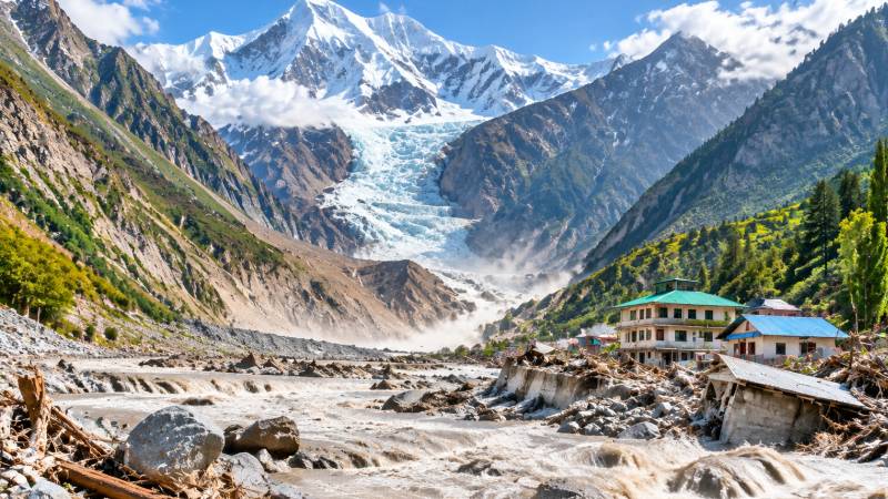
By now, everyone has seen the shocking videos of the Tibet–Nepal floods, reportedly triggered by a glacier slip from the Langtang Lirung glacier in Tibet. The videos are so dramatic that both real and AI-generated footage are likely to become part of the archives of disaster voyeurism. Disasters in the modern era often create captivating spectacles, but behind those spectacles lie heartbreaking, impersonal statistics of death and destruction. There are thousands of dead and injured, with thousands more missing. Yet the lives shattered by such tragedies cannot be captured by numbers alone. They can only be understood and felt if media accounts allow us to see the human stories behind the disaster and if our own humanity enables us to do so.
Politicians, activists, scientists and the public will debate if the disaster was because of climate change, in the months and years to come. Perhaps it was, but to my mind it doesn’t matter much, if it was or not. The point is that Himalaya/Karakoram/Hindukush mountain zone is the most dynamic region in the world. The cryosphere (glaciers & snow), air and weather (climate), ground and plate boundaries (geology) and streams and river (hydrology) are all on the move, faster than anywhere else on the planet. Such a seismic, cryospheric, hydrologic and climatic dynamism demands caution, humility and respect from the human societies which pretend to lord over the region. But sadly, none is to be had.
We have had a very small sample of what the landscape is capable of doing in Nepal. There is absolutely nothing that humans can do to prevent glacial lake outburst floods or glacial slips/collapse. The only things that can be done are public education, monitoring, evacuation drills and keeping infrastructure and artificial obstructions out of the way of a prospective flood. These are precisely the things that all the countries of the region are either not doing, or doing less of, and in all the cases, especially Pakistan and China, doing the opposite of.
There is little humans can do to prevent a glacial lake outburst flood or a major glacier collapse. What we can do is prepare: educate communities, monitor hazards, conduct evacuation drills and keep infrastructure out of the path of potential floods.
My friend Hassan Abbas said in a discussion on the Tibet Nepal 2026 flood, that Pakistan’s glaciers are a hundred times bigger than the Langtang Lirung glacier, and its streams, e.g., the Shyok and Indus Rivers are more than a hundred times bigger than the Lhende Khola and Trishuli River systems that were affected by the floods. And then Pakistan alone is building or has built some of the world’s highest dams in the Indus River system—Diamer-Bhasa, Dasu and Tarbela dams, which will make any disaster much worse. The point is that a comparable event to Langtang Lirung in the Karakorams will be much, much worse and we have record of one such event.
Few will know about, and one or two alive will remember the August, 1929 Chong Khumdan-Shyok flood in the Indus River. It is well documented in the archives of the Flood Forecasting Office in Lahore. The Langtang Lirung flood pulse caused damage up to 100 km downstream of the origin of the flood. The Chong Khumdan-Shyok flood caused a 15 meters high flood wave at Attock, which took out the railway bridge, almost 1000 river kilometres from its point of origin. The Langtang Lirung flood swept away six hydropower projects and damaged another twelve. The Chong Khumdan-Shyok flood mercifully did not have any dams to sweep away, and the populations in the basin were quite sparse in 1929.
Most of what we know about the Chong Kumdan-Shyok flood in the Indus is based upon a report written by J.P. Gunn an Executive Engineer of Punjab Irrigation Department. In the absence of a gauge network he had to rely on estimates and modern experts can quibble with the numbers. But the basic point is that the world is shocked by the stupefying spectacle, and damage caused by the Langtang Lirung flood. Do we even dare imagine what Chong Kumdan-Shyok flood would do today? The flood will happen, it’s just a question of when.
In a relatively tame tributary of the Indus called Jehlum, under a relatively civilized monsoon flood pulse in 1992, Pakistan almost lost the world’s second largest Mangla dam. And in order to save Mangla, all gates had to be opened causing catastrophic damage downstream. The Chief Engineer of the dam went to prison. What will the existence of the Indus cascade, if completed (God forbid) mean for a Chong Kumdan-Shyok style flood in Pakistan today, or in the future? The flood will happen, we just don’t know when.
Dam builders may insist that the Diamer-Bhasha Dam can withstand large floods — even in one of the most seismically active zones in the world, situated on top of a fault line. However, back-of-the-envelope scenario calculations suggest otherwise. Floods the size of the Langtang Lirung event occur in the Karakoram region and often go unnoticed. Such floods are insignificant only in comparison to the immense geomorphic power of the Indus River basin. When glaciers in the Indus Basin surge or collapse, no dam in the world can fully stand in their way. Scientific prudence and evidence-based caution point towards a different path. The question is: are we willing to heed the warning?