By and large, it had become a norm to ignore writing local history in Pakistan. Plainly, ‘local history’ and ‘architectural history’ are not mainstream subjects for trained historians. On the other hand, architects and town planners consider these subjects fluid, descriptive and not solid. Therefore, they ignored these subjects from the inception. Recently, some engineering universities have started to cover these areas through their M.Phil. and Ph.D. programs.
It is encouraging that a number of books in Sindhi and Urdu language are being published on large and small settlements. A majority of these are authored by amateur historians. In 2020, at least 11 such books were published in Sindhi. This scribe read all of them and has found four common patterns in the text. First, books opened with an account of the beginning of a settlement – in other words, who came first to the settlement or founded it. Second, all authors ignored the landscape of settlements. Third, details about buildings – schools, hospitals, mosques, temples and revenue offices – are unsystematic. Fourth, stories about ownership and occupancy of buildings in the context of the 1947 Partition are fragmentary.
With the help of the above mentioned four patterns, this brief easy explores what the authors have missed while writing local histories. This writer has benefited from the online seminars organized by the Institute of Historical Research, London, in preparing an outline of this essay.
As mentioned earlier, most of the authors have started their books with some discussion on people who came and started the settlements. However, all the books are silent about the cause of such a significant move. There might have been more than one reason, but geological formations, physical geography and local morphology always set a general rule about the establishment of a settlement.
Early settlers’ experiential learning was unconsciously embedded in the scientific principles of these subjects. In sum, it may be concluded that Sindh’s earlier settlements were constructed at a safe distance from natural drains. The inhabitants learned two important lessons. One lesson was that settlements in low-lying areas got flooded in rains, and lesson two was that the dwellings in the catchment areas of the Indus were unsafe zones, especially in the monsoon seasons. In both cases, non-compliance led to losses - human losses, material losses, destruction of livelihoods and migrations. It happened because sometimes peoples’ experiential learning failed to approximate Indus river’s characteristics such as flood frequency, volume of water, and its silt-carrying capacity. In this regard, a classical example is the Kalhora kingdom’s capital which was shifted four times due to flooding in the Indus river. Much later, when Sindh became part of the British Empire, then the Indus river was “tamed” with the construction of canals, bridges and barrages. Different types of protection bunds also controlled floods.
Sometimes peoples’ experiential learning failed to approximate the Indus river’s characteristics such as flood frequency, volume of water, and its silt-carrying capacity. In this regard, a classical example is the Kalhora kingdom’s capital, which was shifted four times
One must remember that water has a dual role in human settlements. None of the settlements could be established without water. On the other hand, water in the form of floods and heavy rain adversely affects human settlements. The recently published books on cities and villages have mentioned floods of 2010 and rains of 2011. But none of the authors have explained the major causes of sinking of towns or villages. This, despite the fact that it was apparent that in most of the cases choked natural waterways or artificially filled depressed areas for new housing projects were the lead causes. In this regard, one example in recent times is of Mithi town of Tharparkar district, which was flooded in the rains of 2003 and boats. Another example is of Khairpur Nathan Shah of Dadu district when the flood of 2010 converted the town into a huge pond. Similar is the case of Badin city in southern Sindh.
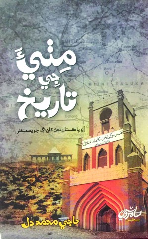
History of Mithi, Tharparkar
It is worth reminding that there is an inverse relationship between old areas of the settlement and sinking. This is because the old areas were constructed at a relatively elevated terrain. In subsequent years, however, the low-lying areas were inhabited in a piecemeal fashion. Therefore, flood water or heavy rain water first sinks lower areas and then gradually reaches the elevated parts of towns or villages.
The second flaw noticed in all books was the lack of relationship between the landscape and a specific settlement. Again, there is an example from Mithi which has a dune known as Gadi Bhit located in the west of the town. Long ago, it was an isolated area and used to add scenic beauty to the town. However, regular human interventions such as the construction of roads, rest houses and parks have considerably disfigured it. Nowadays, the first look gives the impression that it is an elevated structure rather than a natural dune. This type of description is almost nonexistent in all books.
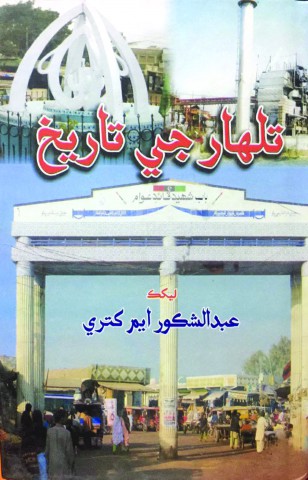
History of Talhar Town
A common topic in all books is a discussion about buildings. The types of buildings under discussion were schools, dispensaries, shades, and lower-revenue offices. But most authors failed to help readers in figuring out the locations of these buildings. None of the books tell us about the direction in terms of ‘North, South, East and West’. The writers have usually referred to the buildings in a very loosely defined set of words such as ‘near, far, behind, and front’. Therefore, readers may not understand the spatial context of the settlement. Another missing piece of useful information pertains to how the land was acquired to construct the buildings: was the land given by the government or was it privately purchased? In either case, the writers should cite primary sources, like government records or the sale and purchase deed. Then comes the description of structures/buildings which should be accompanied with a layout map showing all relevant reference points. If it is a ground-plus-one structure, then the description of buildings should start from the base structure, and then it should move on to first floor.
The 1947 Partition, as an event, in a single stroke changed ownership and occupancy, and it happened at a large scale. Just imagine how the complexion of whole neighborhoods, colonies and residential societies changed
The description about buildings in the books under review generally mentions that such and such building was constructed before Partition, and its owner was Seth X, or Maharaj Y or Z Singh. Therefore, it could be accepted that all of them have unknowingly introduced the aspect of how Partition caused changes in ownership and occupancy. But none of them have sufficiently mentioned as to how many times owners and occupants have changed and what were the reasons. In the case of our part of the world, some events such as riots, non-availability of services and even a rise in crime rates in a neighbourhood cause changes in ownership and occupancy.
The 1947 Partition, as an event, in a single stroke changed ownership and occupancy, and it happened at a large scale. Just imagine how the complexion of whole neighborhoods, colonies and residential societies changed. The worst examples are from Hyderabad, Lahore and Karachi. A nefarious role was played by the Ministry of Rehabilitation and Settlement of the Government of Pakistan. Its worst conduct was allocation of the same building or part of the building to different people, without knowing the previous sale and purchase status or occupancy status.
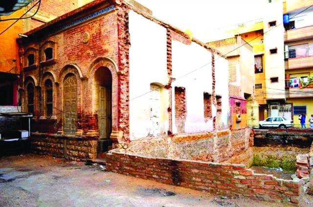
Another mischief of the Rehabilitation Ministry was allocation of grand mansions to different claimants. One aspect must be noted that in many cases the profiles of vacated mansions’ owners and that of the newly occupants were mismatched. Therefore, the post-partition occupants tended to alter a building’s exterior and interior layouts. Generally, it happened in the shape of construction of additional rooms, toilets, shops and stores. None of the recently published books on cities and towns in Sindh have set the socio-political and cultural context of these ‘ugly additions’. Nawaz Ruknani in his book entitled Dadu Sindh Ji Dil (Dadu: The Soul of Sindh) writes that after partition, whole well-developed neighborhoods owned by Hindus were allocated to migrants. According to him, new occupants did two things: firstly, some of them sold the allotted houses, and, secondly, some of the occupants belonging to lower strata of society dismantled doors and windows, and sold them for their immediate needs.
Let me conclude that it is a positive sign that lots of books are being written and published on the cities, towns and villages of Sindh. These books are based on oral history, recalled techniques or secondary sources.
However, enthusiastic writers must portray facts in appropriate contexts, and differentiate between facts and speculation. The level of detail when it comes to the writings on buildings and structures should be enhanced so that a finer picture could emerge. In addition to that, the tenancy history of buildings should be set in context. This writer earnestly believes that if these suggestions are appropriately taken, then the usefulness and “shelf-life” of books on settlements would increase to the level of proper reference books.
Dr. Zaffar Junejo has a Ph.D. in History from the University of Malaya. His areas of interest are post-colonial history, social history and peasants’ history. Presently, he is associated with Sohail University and Institute of Historical and Social Research, Karachi
Dr. Zaffar Junejo has a Ph.D in History from the University of Malaya. His areas of interest are post-colonial history, social history and peasants’ history. He may be reached at junejozi@gmail.com