Minister for Climate Change Sherry Rehman has hinted at the slowing down of Cyclone Biparjoy, but said the "core remains intense", urging the citizens to continue to observe caution.
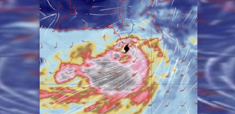
The cyclone currently classified as a "very severe cyclonic storm", would likely make its landfall sometime tonight or after midnight.
Pointing to a break in the momentum of the storm, Rehman said on Twitter, "It will not make landfall before nightfall now. More information will be shared soon from the National Disaster Management Authority."
In a forecast by around 6pm today, Pakistan Meteorological Department (PMD) said the cyclone would likely pass by Sindh's Keti Bandar and India's Gujarat within the next "two to six hours".
According to the alert, it had been moved northeastward and was currently at a distance of some 245km south of Karachi, 210km south Thatta and 145km south of Keti Bandar.
Read this too: ‘Disaster Tourism’: TikTokers Barred From Filming Cyclone Biparjoy
As the cyclonic storm draws close, the coastal as well as Karachi's urban areas have begun to experience rainfall. Evacuations have been underway during the past two days as authorities target moving at least 0.1m people to safety before the cyclone hits the country's coastline and causes destruction.
A day earlier, the minister warned TikTokers not to use the cyclone to boost their social media popularity.
"Citizens are urged to not engage in disaster tourism by heading towards the beach to watch the cyclone, or to treat the strong tides as a dangerous backdrop for TikTok videos," she had stated on Wednesday.
The government, after watching citizens expose themselves to the threat, decided to stop them from endangering their own and others lives.
The authorities made it clear that the cyclone wasn't something to celebrate but it was time to help those most vulnerable to the threat.