As my friends and I passed through one of the Babs (arched-doors) of Hala Town, we immediately took a left turn onto the Bhanot Road, heading east. Along the way, we crossed a dilapidated complex of buildings – bungalows, offices and flats. The main gate of the complex was wide open, without any restrictions. However, the faded red-brick-coloured compound wall displayed some welcome chalking in honour of the Amir of the Jamaat-e-Islami, Siraj-ul-Haq.
While passing the compound wall, I noticed the fresh calligraphic chalking, which reminded me of the 1980s, when Sindhi Shagrid Tahreek’s wall chalking used to be uniform and artistic across Sindh. The present chalking by Jamaat-e-Islami took me back to the 1970s, reminding me of a chalking I saw in Kotri, which read: "Aik, Aik Bacha Kat Marega, Bangladesh Naheen Banega" (“Each child will be sliced to stop the creation of Bangladesh”).
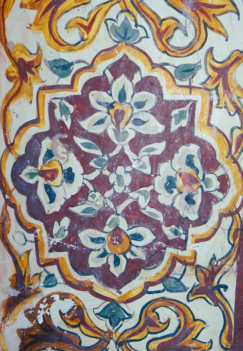
Floral designs on the exterior wall of Mir Fateh Ali's Tomb
As we continued our journey, I was mesmerised by the half-ripened wheat crops on both sides of the link road. The fresh countryside air filled the car as I lowered the window’s glass, carrying the delightful fragrance of wheat’s anthers. The car’s ambiance changed and the driver connected his Bluetooth to the sound system and played Uris Faqir. His melodious voice quivered into the car.
The Bhanot link road was narrow and bumpy. Soon, we encountered an intriguing structure adorned with triangular green flags, black flags and red stripes. Alongside, some mature Conocarpus trees with painted trunks stood tall. Nearby, an old Sindhi-styled structure caught our attention – a big room with wide-arch-shaped doors. We came across people filtering Bhang (South Asian cannabis drink), who offered us a sip, but we politely declined. We inquired about a religious structure we had seen earlier and they informed me that it was the Mazar of Jhando Faqir, from the new Khudabad. I encountered an elderly local who informed me about dismantled structures, mentioning that fragments of these structures were used by nearby villagers for the construction of their homes. He sarcastically remarked that some buildings were saved due to their Islamic appearance, but if they had been seen as Hindu structures, they might have been replaced with wheat and mustard fields. His observation raised a lot of questions about our perceptions and attitude.
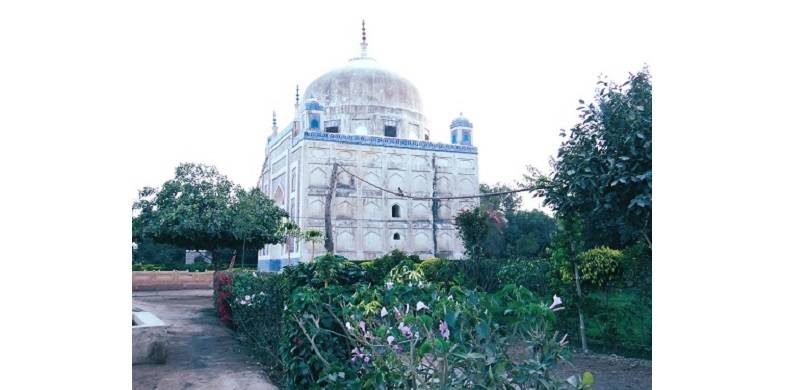
Continuing our exploration, we reached Mir Fateh Ali’s tomb, a square-shaped structure with an octagonal small-bridge-type structure on top crowned by a semicircular dome. Inside the tomb were five graves, including those of Mir Ghulam Ali Khan Talpur, Mir Fateh Ali, Mir Sobdar and Mir Fateh-ul-Azim. There was also the tomb of Mir Bahram Khan nearby. The tomb has raised over pillars with floral and petal designs. There was an elevated platform on which Mir Bahram’s grave rested. The shape of the tomb was an octagonal drum on which the crescent dome is placed. However, the top of the dome has designs of reversed lotus flowers. We moved towards the west from Mir Fateh Ali Khan’s tomb and saw a Tajar (a type of architecture and a place where royal females are buried). There were two entrances from the west and from the east. The basement was erected with yellow stone, and it was decorated with floral designs. The exterior panels were whitewashed. Tajar’s dome is silken with inverted lotus flowers. There were two graves on a raised platform. However, on the southern side, there are two graves of children.
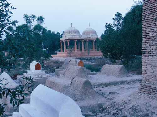
Now a graveyard of Chandias and Dhahris (Khudabad Sani near Halla)
A thought came into my mind about the people who came to Khudabad Sani and wrote about it. I looked at my notes and found that one of the earlier accounts was by John Wood, a lieutenant in the Indian Navy who was part of the “Mission Proceeding to the Indus” as an assistant to Alexander Burnes. His memoirs of the voyage were titled Personal Narrative of a Journey to the Source of the River Oxus the Route of the Indus, Kabuland Badakhshan, published in 1841. In his account, he describes Khudabad Sani as the ruins situated a little to the northwest of Hala, covering an area of two square miles. He mentions that it was a favourite residence of the Talpurs. Moreover, he points out the mausoleum of Fateh Ali Khan and his brother Mir Ghulam Ali lying side by side under one dome. Wood expresses his concern over the fading and crumbling architecture of Sindh, remarking how easily the antiquary might mistake mounds of yesterday's formation for ancient relics in such a region.
Another significant work on Khudabad Sani is Henry Cousin's Archeological Report, The Antiquities of Sind, with Historical Outline. The report includes photos of the ruins taken in 1896, along with historical information about the structures. It is worth noting that many authors, with or without citations, have paraphrased or copied John Wood's descriptions of Khudabad Sani. Edward Thornton's Gazetteer, published in 1844, is another frequently cited book that relied on John Wood's work and the East India Company's miscellaneous documents regarding Khudabad Sani. While earlier English reports mentioned that the ruins covered an area of 2 square miles or 1280 acres, the current area has been reduced to less than 100 acres due to various factors, including the construction of a protection Bund, link roads and watercourses. Now, it has become a graveyard of Chadia and Dhahri communities.
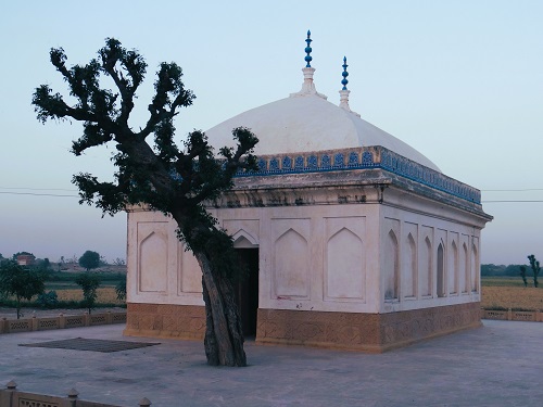
Tajar - Khudabad Sani (Hala)
Khudabad Sani was established by Mian Sarfraz Kalhoro in 1774 and served as one of the capitals of Sindh: it was a populous town. However, internal tensions between rival parties, particularly the conflict between Talpur Sardar and Rajo Lakhi, led to a full-fledged war. In the war, the Kalhora dynasts lost and the Talpurs emerged victorious, making Khudabad Sani the residential-cum-official place. Nonetheless, various natural and military-political reasons eventually pushed the Talpurs to shift to Hyderabad, leading to the abandonment of Khudabad Sani, which was first reported in 1814. Researchers unanimously agree that the town was desert within fifty years.
The primary reasons for its desertification were the scarcity of irrigation and the change in the course of the Indus River, leading to a gradual migration of the inhabitants. MH Panhwar delved into the deserted town's story and summarized that in 1758, the changing direction of the Indus resulted in the desertification of one million acres. The ongoing conflict between the Talpurs and Kalhoras for 25 years ultimately resulted in the victory of the Talpurs. The words of the old man that I met during my visit echoed in my mind, describing the bad luck the place had faced. I pondered the sudden reduction in livelihoods, external threats and communal conflicts that compelled those in power to prioritise their own security over rationality and accommodation, leading to a conspiracy of sorts.
As the sun began to set, we decided to return, but the question of how this once-thriving capital was ruined continued to haunt me. Before researching its desertification, it is essential to acknowledge the historical significance of Khudabad Sani, its role as the capital of Sindh and its eventual downfall due to various internal and external factors.
We ought to better explore the reasons that led to the desertion of this historical site.
Dr. Zaffar Junejo has a Ph.D in History from the University of Malaya. His areas of interest are post-colonial history, social history and peasants’ history. He may be reached at junejozi@gmail.com