The present write-up is on a family trip that this author undertook to the Kaghan, Indus and Naltar valleys this season. This is continuation of part I published in this space earlier.
Every person who can afford to, must do rafting at least once in their lifetime. It is a wild experience unlike any other. As the riders staring nervously at the angry waters, foaming waves thrash against and rapids and throw the tiny boat up and down while the cascading water splashes on their faces. It is an unforgettable rollercoaster ride.
On the third day of our trip, we went rafting in the rapids of River Kunhar. Rafting stations have been set up by some entrepreneurs along the river near Soch village, a short distance east of Naran. The packages offered are for runs of 1.5, 5 and 8 kilometers. We took the longest trip at Rs. 2,000 per head for eight persons per boat.
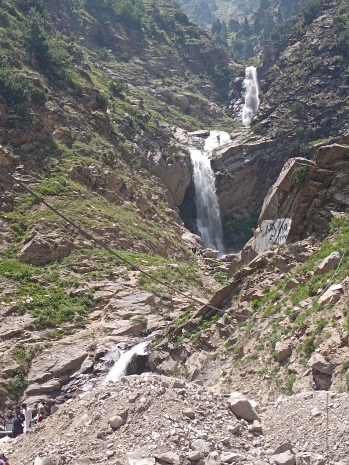
Naran Waterfalls
Wearing our life jackets and helmets, we crammed into the Chinese-made rubber boat. Each person sitting on the side was handed over an oar. The boat-master gave us instructions on where to sit and how to row. Then he pushed the boat into the river and the currents did the rest. The boat floated into the fast-flowing water, rolling over the rocks and crashing down the falls. We all, as indeed persons in the other boats, shouted gleefully as the water was sprayed on us, filling the boat. Cellphones and wallets had to be stowed away to protect them from being drenched. On entering the rapids, the boat went out of control, steered at its own and circled around the swirls. Oars were, evidently, only slightly effective as the boat entered relatively calm waters. High mountains on both sides, the narrow valley, ferocious river, the rapids over the rocks, water gushing down the steep slope, peaks rising through the velvety clouds and the tiny boat rollicking in speeding water created a surreal scene. The whole run can aptly be termed as Fast and Furious.
We enjoyed the first run so much that we opted for a second one. On this turn, as the boat-master learned that we all knew swimming, offered that we could jump in the river where the water was calmer. I looked at the rapids and then at him in disbelief. However, he took us to a place where the riverbed was wide and the boat slowed down. My elder daughter and all three granddaughters jumped into the cold water. As they couldn’t come back to the boat due to the movement of the boat, they swam away to the bank – much to the relief of the onlookers, who wouldn’t have known that these girls were all excellent swimmers. It was a real treat seeing them enjoying a memorable dip that I couldn’t take due to my heart condition. Rafting was like a 200-feet-deep, 8-km-long water slide. On the way back, some of us took a turn on the zipline., erected between the river and the road. All in all, the day had been full of fun.
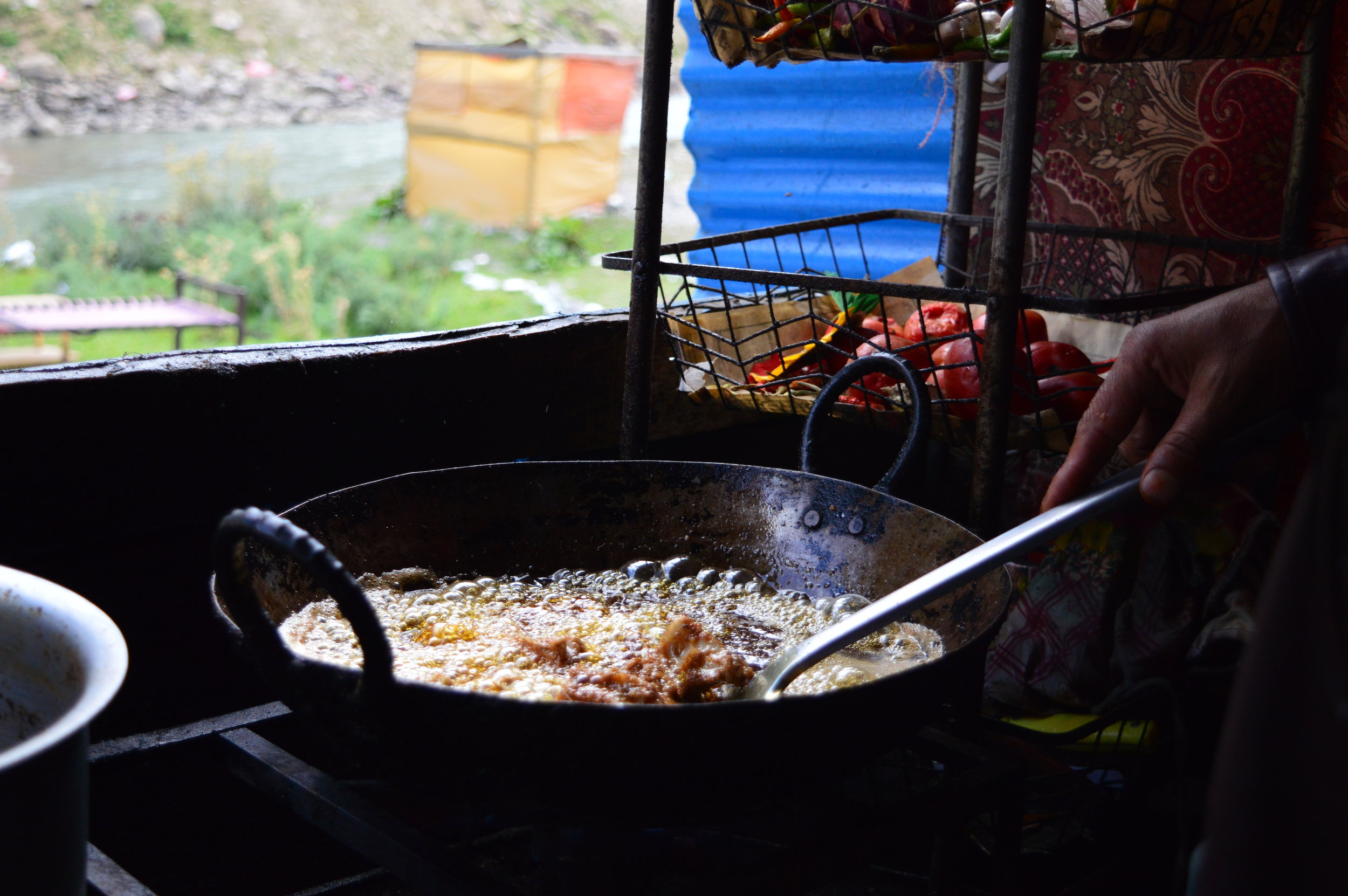
Frying trout
Kaghan Valley offers delicious fried trout fish. There are trout farms along the river. We had this delicacy twice during our stay. For those – like this author – who worried whether the offer is truly trout or some other variety, I assure them to relax on this score. One eating trout knows by its crispy flesh, thin skin and light meat that it is something special.
We were lucky to come across a live trout. The hotel we were staying in had an artificial waterfall in its lawn. It was supplied water through a waterpipe laid into the Jheel River – a common practice for drawing water in Naran. One evening, when the kids were playing in the lawn, they spotted a fish in the pond below the waterfall. One of them was able to catch the slippery brown fish. It turned out to be a medium-sized trout. Later, we let it flow in the water channel that led to the river.
Naran is a summer town. Its population of thousands during the April-September period dwindles to a few hundred in winter. Most of the seasonal workers come here from various parts of KP and Punjab for six months, make their money and go back. I spoke to such a worker who was running a tire repair shop from a shack set up on the roadside. He belonged to Lahore and for last few years was spending his summers in the cool environs of Naran. He reminded me of the rich jetsetter class in our country who leave dust, heat and humidity behind and travel to European destinations for the summer. I thought that this guy living in his tent overlooking the River Kunhar, commanding one of the best scenes in the valley, was having a better time than those vacationing in Europe.
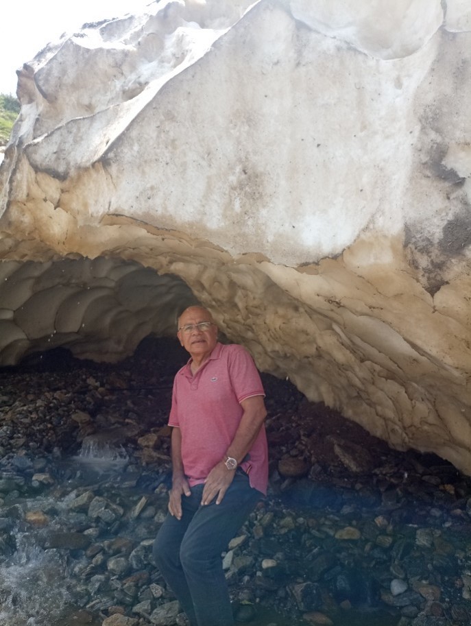
The author, under a glacier
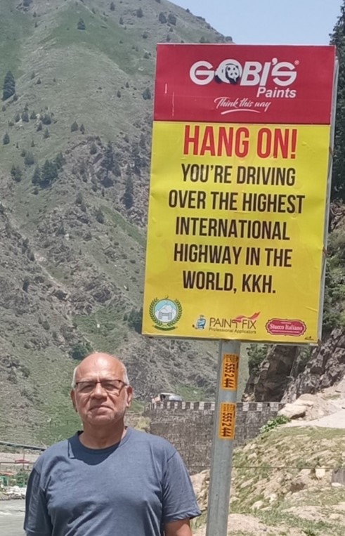
On the third day, we packed our cars and drove off to Babusar Pass via this segment of the Karakoram Highway (KKH). A signboard informed us that it was the highest international highway in the world. Soon we stopped to view the multi-layered Naran Waterfalls, 10 km from Naran. This stream originates from the northern edges of Malika Parbat, across the ridge that separates it from Lake Saiful Malook valley. The stream flows in a steep channel. In merely 1,000 meters before merging with the Kunhar, the stream descends through 1,000 feet at a heart-trembling 33% inclination and spills over the road before falling into the Kunhar. The waterfall is such a lovely sight that no tourists go by without stopping for some time to digest the scene. Many people walk up to the first or the second part of the fall. The road to Babusar offers many such sites where nature is at its best with many streams and glaciers flowing over the road to merge with the river. No wonder that the road remains closed for the winter months.
A little ahead of the waterfalls, we spotted another stream flowing over the road and a remnant of the glacier with its gaping mouth sitting on the road edge. It’s a rare scene but our northern areas are replete with such sights. We couldn’t help but go under the glacier; a dangerous thing to do as it could have collapsed at any time. A jungle guard was on hand to stop tourists from going in the mouth of the glacier, to ward off accidents. In one such accident a few years ago near Lake Saiful Malook, a few tourists had lost their lives. However, the chance presence of a melting glacier was too compelling to resist. We all went under for experience and pictures. In fact, when we returned three days later, the glacier had melted away.
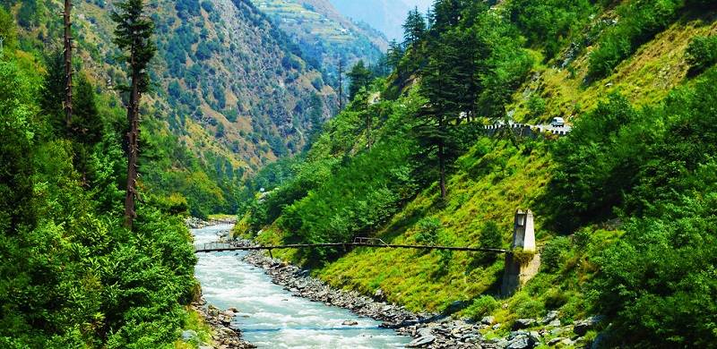
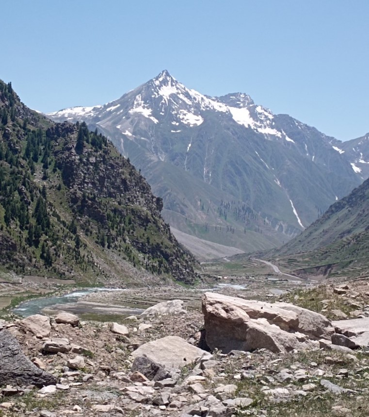
We then headed towards Batakundi which is fast developing as an attractive tourist spot with construction of many hotels and restaurants. It is also the launch pad for the picturesque flat ground of Lalazar at an elevation of 10,500 feet and accessible by a jeepable track. Those desirous of visiting the place must devote one full day, which we did not have. We drove on, crossing the iron bridge over a huge stream called Dadar Nar whose origins lie in the 14-15,000-ft-high mountains to the south. One of these mountains is Malika Parbat and others are still unnamed. As the reader can visualise, this road runs in the foot of snow-covered high peaks that disgorge their wealth of water to feed the river Kunhar on their western slopes and river Neelum on their eastern foothills. Both these rives run parallel roughly north to south and join River Jhelum near Muzaffarabad a few kilometres apart.
The Jhalkand-Sharda road is an unpaved, perilous and strategic track, traversable during June-September period. Only the experienced and undaunted thrill-seekers should undertake this course on especially modified 4x4 vehicles
At Burawai, the road crosses a big stream called Jora Nala and then the Kunhar itself and runs on its right bank. For ten kilometers from Burawai to Jhalkand, the 4,580 m- / 15,026 ft-high majestic Tiger Peak dominates the southern horizon. This place is also a base camp for tracking to the peak. Because of resemblance between the two, Tiger Peak is also called “mini K2.”
Majestic Tiger Peak
Jhalkand is developing as a tourist stop. It’s a very scenic attractive place with a wide valley where the Jhalkand Nulla, flowing from the western slopes of 12,900 feet high Noori Top, joins the Kunhar. Some terraced farming on the eastern side of the Nulla was visible. Jhalkand is a popular camping ground. Many enterprising souls had camped for the night with their jeeps parked around the shallow water. A number of restaurants had been established. The confluence is also the launch pad for the Jhalkand-Sharda road over the Noori Top linking the Kunhar and Neelum valleys. The road follows the Jhalkand Nulla, goes over the Top and then descends along Gal Valley stream, which is a tributary of the Kalegander Nar. The road follows the Nar till it merges with the Neelam Rive at Sharda. It is an unpaved, perilous and strategic track, traversable during June-September period. Only the experienced and undaunted thrill-seekers should undertake this course on especially modified 4x4 vehicles. Jhalkand is also home to Pyala Lake; a small perfectly round water body. We drove on, looking far into the Jhalkand Valley on our right, at the snow-covered fringes of the Noori Top. At the same time, 13-15,000-feet high snow-covered peaks, that divide the Indus and Kunhar Valleys, gazed down on us from our left.
From Jhalkand till Babusar, there were numerous streams descending from our left. We stopped at another site called Besal. At this point, the river valley is a bit broad with Purbi Nar merging with the river from the east and the Sadullah Nar from the west. Purbi Nar carries the waters of Dudipatsar Lake, one of the major sources of the Kunhar that is about 15 kilometers away and is frequented by many a brave-heart on foot.
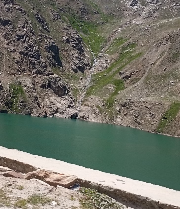
A little ahead of Besal, on the left side of the road, lies the beautiful semi-circular lake of Lulusar, which is the other major headwater of river Kunhar. Behind its crystal-clear blue waters, are visible many of its feeding glaciers. When we stopped at the lake, the tourists were thronging the place. The restaurants on its edge were doing a brisk business. The lake ends at a place called Janbaz Baigh from where a jeepable track runs parallel to the Babusar road and terminates at Chillas town. We stayed at the lake for half an hour, which doesn’t do justice to the beauty and serenity of its calm waters.
Crossing Gittidas, a little short of Babusar Top and at a sharp turn to the left, a signboard informed that we were at the confluence point of three regions. We parked on the roadside and tried to decipher its meaning. With some knowledge of geography and a lot of help from google-maps, we realized that we were looking on our right, a little east of Lakes Dharamsar and Sambaksar, at a triple-point at elevation of 14,800 feet where the boundaries of KP, AJK and GB meet. More than the political boundaries, it is also a point where three ridgelines intersect. These mountain ridges are watersheds that separate the Indus, Kunhar and Neelum valleys and also form boundaries of three regions.
Standing on the roadside as I stared at that geological cum political feature, it occurred to me that it was possible for three rain droplets falling in unison at this point and splitting, to flow individually through different paths into the Rivers Neelum, the Kunhar and the Indus, reuniting upstream of Chachran Sharif near Panjnad and then flowing down together to the Arabian Sea to restart afresh their cycle of life. These are truly amazing journeys, like three siblings or three childhood friends, who grow up together in the same house or neighbourhood, pursue their own life-paths to reunite in their old age before losing their individual identities to become part of the cosmos to enable their composite cells to start life afresh. Human life cycle imitates nature.
With the rise in tourism, Kaghan Valley – in particular Naran and Batakundi – are witnessing an unplanned construction boom. It’s the job of the government to prepare a master plan for future development. As one enters Naran town, a sign board offers welcome from its village council, implying the existence of this elective chamber. If such an august body exists, its absence is acutely felt from lack of any regulatory work. The least it can do is provide trash bins in the bazaar and the bylanes.
Lulusar Lake
As stated earlier, Naran is a busy place during the summer season. Its hotels, restaurants, and shops do a brisk business but there seems to be no regulation to supervise them. Restaurants can use some training in cleanliness, standard of service and politeness. It is for the KP government to establish vocational institute in the valley to train workers in hospitality business. We thought that the waiters and managers were ill-trained to handle their patrons in a decent manner. The standard of service remained poor throughout our trip except at a few places.
Having travelled extensively inland and overseas, I have come to realise and accept that we, as a nation, are not 'toilet' trained. There is no way that we can keep a public toilet clean. Rest areas in some hotels and motorways employ permanent workers to keep these places clean and dry; something that small establishments can't afford. We lack the responsibility of leaving a rest room fit for use for subsequent visitors. Perhaps, we don't even attach the concept of cleanliness to toilets and have not graduated from ‘pa-khana' to washroom. This issue is a bane of travelling in Pakistan, especially with children and old ladies. Some toilets on the entire route were simply unusable. The tourism and hospitality industry need to be educated on this vital requirement if they want to attract tourists, especially from abroad.
The next part of the article will cover our passage through Babusar Pass and travel to Gilgit along the Indus River.
Parvez Mahmood retired as a Group Captain from the Pakistan Air Force (PAF) and is now a software engineer. He lives in Islamabad and writes on social and historical issues. He can be reached at: parvezmahmood53@gmail.com
 From Jhalkand till Babusar, there were numerous streams descending from our left. We stopped at another site called Besal. At this point, the river valley is a bit broad with Purbi Nar merging with the river from the east and the Sadullah Nar from the west. Purbi Nar carries the waters of Dudipatsar Lake, one of the major sources of the Kunhar that is about 15 kilometers away and is frequented by many a brave-heart on foot.